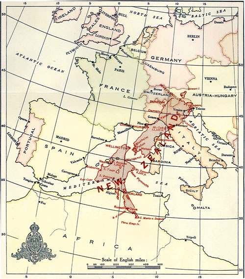
This map from the 1919 Year Book shows where New Zealand would be situated if placed in the corresponding Northern Hemisphere latitude, but with east (instead of west) longitude, for comparison with countries on the Mediterranean Sea.
The map shows Tuatapere near to Trieste, Christchurch near Nice, Greymouth on Corsica, Wellington parallel with Barcelona and Auckland not far from Algiers.
The Europe shown in the map is pre-First World War and had undergone considerable changes since its outbreak. By 1919 the Russian and Austro-Hungarian empires had effectively collapsed leaving the borders of central and eastern Europe in a state of flux, as new states (Finland, Poland, Hungary, etc) proclaimed their independence and victorious established powers (Italy, Serbia, Romania, etc) pressed their claims for territorial expansion.
Community contributions