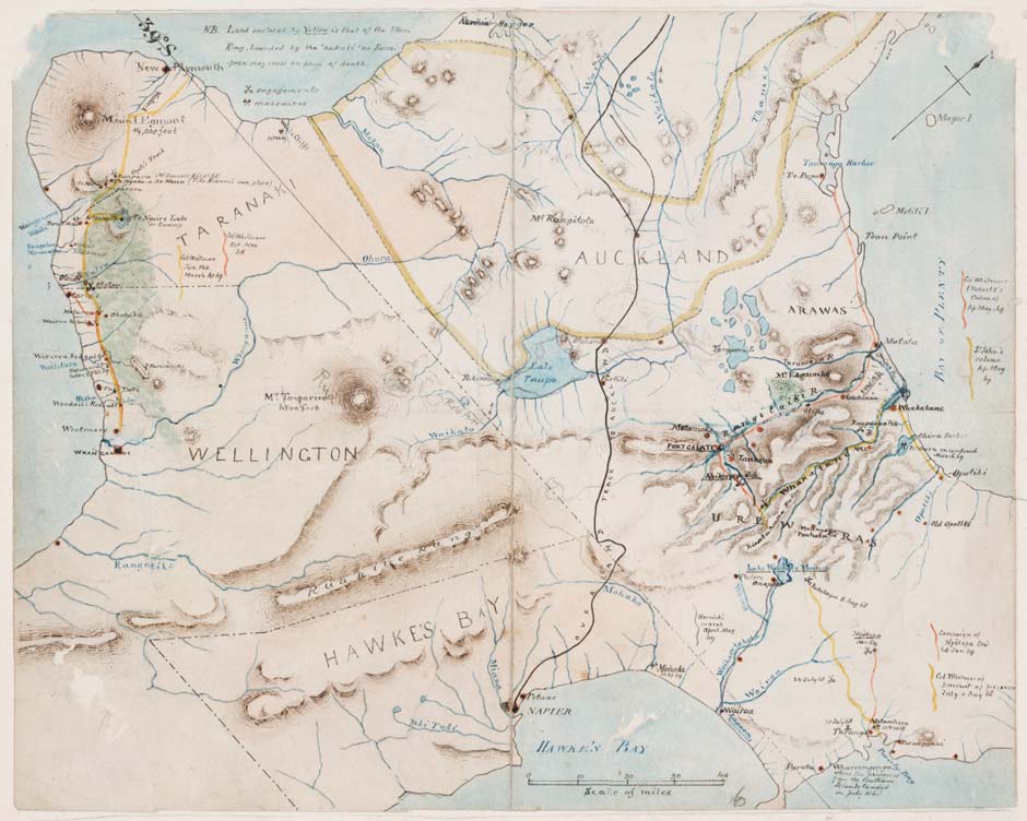
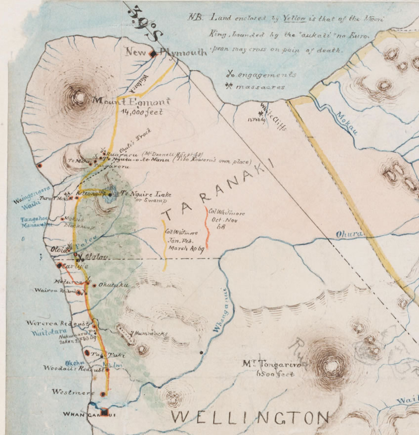
Map created by Howard Hill to show Colonel George Whitmore’s campaigns of 1868–9. Battle sites mentioned in this feature that are marked on the map include Turuturumōkai, Te Ngutu-o-te-Manu, Moturoa, Nukumaru (Taurangaika) and White Cliffs (Pukearuhe) - click on thumbnail to see these.
Tītokowaru’s theatre of war was the 110-km coastal strip between Whanganui and Mt Taranaki.
Reference: Howard Hill, Central North Island showing war campaigns and trails led by Colonel George Whitmore against Maori during the New Zealand Wars. MapColl-832hkm/1868-1869/Acc.5862
Community contributions