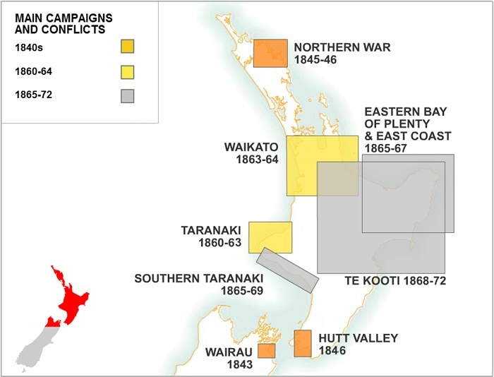
The first clash occurred at Wairau in 1843, when 22 settlers and four Māori were killed. There were subsequent campaigns in the Bay of Islands (the Northern War) and near Wellington and Whanganui between 1845 and 1847.
Fighting resumed on a larger scale in the early 1860s. Following an inconclusive campaign in Taranaki in 1860–61, British imperial troops invaded and occupied Waikato in 1863–64 in an effort to assert colonial authority over the King movement and open up land for European settlement.
As vast tracts of land were confiscated from the ‘rebel’ Māori, the millenarian Pai Mārire movement gathered momentum. Pākehā associated Pai Mārire (‘Hauhau’) with violent resistance to the Crown, and between 1865 and 1867 there was a series of clashes in eastern Bay of Plenty and on the East Coast.
In 1868 new resistance leaders emerged – Tītokowaru in southern Taranaki and Te Kooti in the east of the North Island. Fighting continued into the early 1870s.
Community contributions