Latest comments

Plan showing coal at Charming Creek

Plan showing coal at Charming Creek

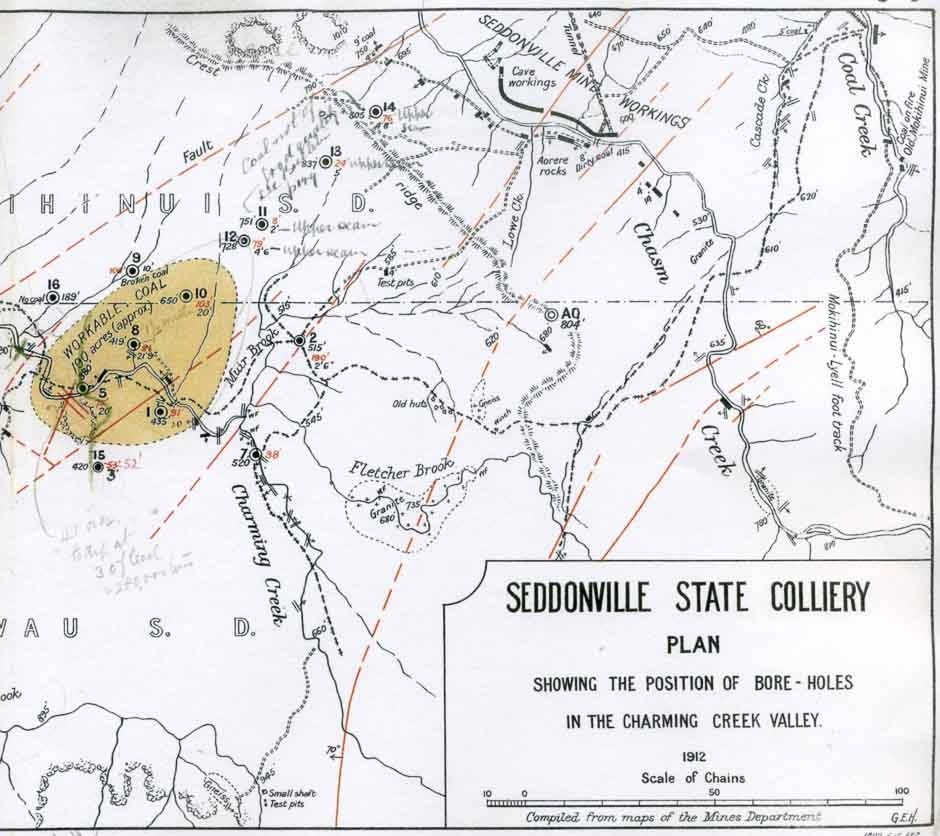
Drilling and detailed geological surveys had shown the presence of an area of coal in the headwaters of Charming Creek in 1911-12. This was outlined in yellow on this map in the annual report of the Mines Department for 1912 (and in later years became known as ‘the yellow blob’). This could have been an extension of the Seddonville State Mine, but in 1913 the government decided to cut its losses and abandon the area. In later years there was considerable interest in obtaining a lease to mine this coal-bearing area.

Appendices to the Journal of the House of Representatives, 1913

How to cite this page: 'Plan showing coal at Charming Creek', URL: http://www.nzhistory.net.nz/media/photo/pland-showing-coal-charming-creek, (Ministry for Culture and Heritage), updated 15-Feb-2009

Community contributions


There are currently no community contributions for this page - please fill out the form to the right if you would like to add your story

What do you know?

Can tell us more about the information on this page?
Perhaps you have a related experience you would like to share?

The content of this field is kept private and will not be shown publicly.
CAPTCHA
This question is for testing whether you are a human visitor and to prevent automated spam submissions.

Comments will be reviewed prior to posting. Not all comments posted. Tell me more...