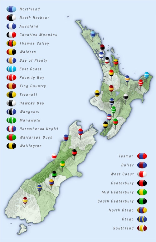
Map showing the boundaries and colours of the 26 regional rugby unions.
In 1879 the first provincial unions were formed in Canterbury and Wellington to administer rugby in their region. A number of other unions followed over the next decade or so. In 1892 a New Zealand Rugby Football Union (NZRFU) was formed to standardise the game around the country. Its foundation members were Auckland, Hawke’s Bay, Manawatu, Marlborough, Nelson, South Canterbury, Taranaki, Wairarapa, Wanganui and Wellington. The major South Island provincial unions – Canterbury, Otago and Southland – initially resisted the central authority of the NZRFU, but by 1895 all three had affiliated to it.
Other unions were created over time – some splitting off from parent unions that had got too large – while some smaller unions amalgamated. In 2015 there are 26 provincial unions in New Zealand, the newest being Tasman, which was created in 2006 as a merger between Nelson Bays and Marlborough.
Community contributions