Taranaki War map 1860-61

Taranaki War map 1860-61

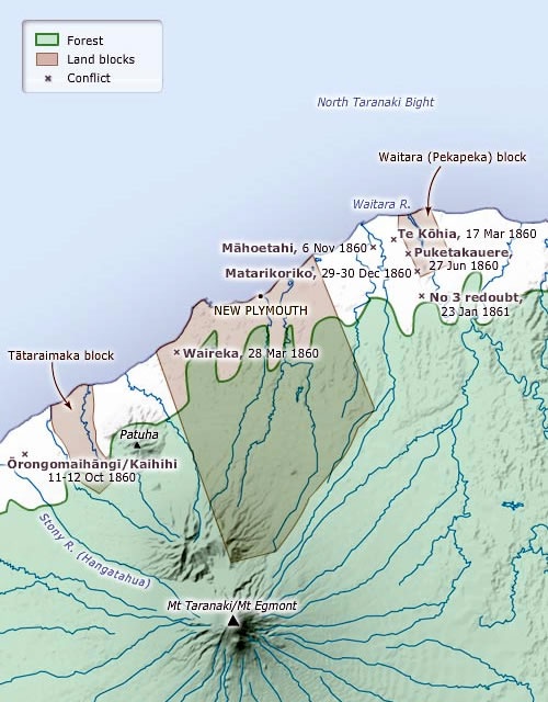
Throughout the 1840s and 1850s New Plymouth settlers lobbied the Crown to buy more land from Maori. In 1859 Te Teira Manuka offered the Pekapeka (Waitara) to the Crown. This was opposed by other Te Ati Awa including Wiremu Kingi Te Rangitake and his followers. Following the disruption to the survey of this land in February 1860 Martial Law was declared and troops occupied the block in March. War broke out in March with an assault on Te Kohia pa near the British position at Camp Waitara. A number of other battles followed before a ceasefire was agreed to in March 1861. The underlying issues remained unresolved and fresh fighting broke out in 1863.

How to cite this page: 'Taranaki War map 1860-61', URL: http://www.nzhistory.net.nz/media/photo/taranaki-war-map-1860-61, (Ministry for Culture and Heritage), updated 18-Mar-2010

Community contributions


There are currently no community contributions for this page - please fill out the form to the right if you would like to add your story

What do you know?

Can you tell us more about the information on this page?
Perhaps you have a related experience you would like to share?

The content of this field is kept private and will not be shown publicly.
CAPTCHA
This question is for testing whether you are a human visitor and to prevent automated spam submissions.

Comments will be reviewed prior to posting. Not all comments posted. Tell me more...