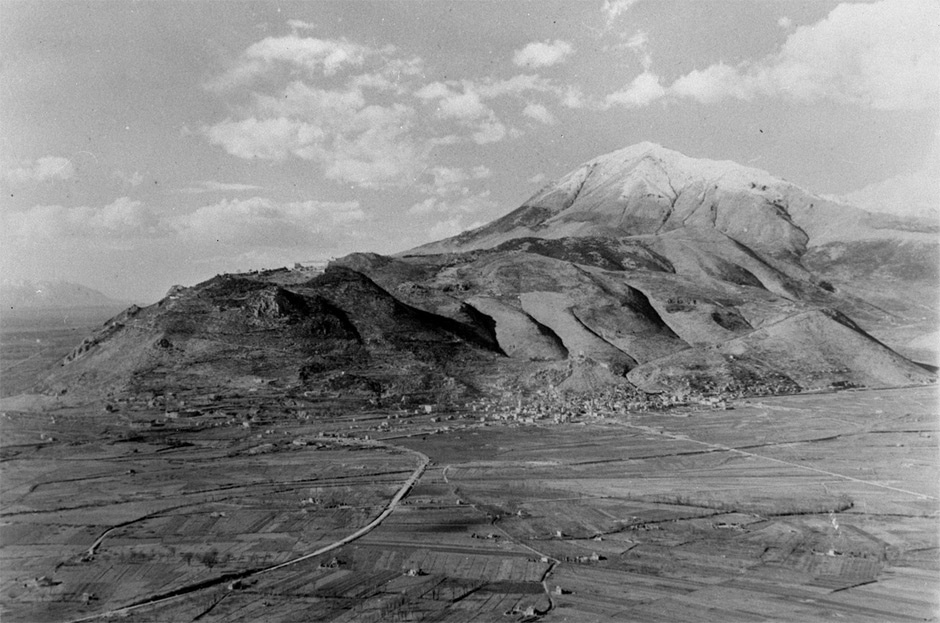
This view of the Cassino area was taken from Trocchio on 2 February 1944, before the town or the Benedictine monastery on Monte Cassino were destroyed by aerial bombardment.
The railway line curves along the lower left-hand side of the image. The rail causeway crosses the Rapido River, which itself extends across the lower section of the image. The road leading directly to Cassino is Highway 6, which ran below Monte Cassino and continued towards Rome through the Liri Valley on the left-hand side of the photograph. The monastery is visible on the skyline to the left of centre, and Castle Hill can be faintly seen directly behind the town itself. The snow-capped mountain in the background is Monte Cairo.
The Germans laid extensive minefields and demolished stopbanks to flood low-lying ground to strengthen their defensive position in the Cassino area before the New Zealanders attacked on 17 February 1944 during the Italian Campaign.
See a map of the area here.
Community contributions