Map of Greece and Crete, 1941

Map of Greece and Crete, 1941

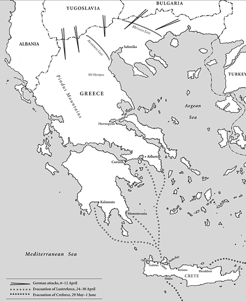
In April 1941 New Zealand soldiers saw their first action of the Second World War in Greece. Stationed at first in the mountainous area in the north, they withdrew under heavy German attack to Mt Olympus and from there to Thermopylae Pass. Survivors of this baptism of fire were evacuated from Kalamata in the south, many of them to Crete.

Original map by Chris O’Brien

How to cite this page: 'Map of Greece and Crete, 1941', URL: http://www.nzhistory.net.nz/media/photo/greece-crete-1941-map, (Ministry for Culture and Heritage), updated 20-May-2011

Community contributions


There are currently no community contributions for this page - please fill out the form to the right if you would like to add your story

What do you know?

Can you tell us more about the information on this page?
Perhaps you have a related experience you would like to share?

The content of this field is kept private and will not be shown publicly.
CAPTCHA
This question is for testing whether you are a human visitor and to prevent automated spam submissions.

Comments will be reviewed prior to posting. Not all comments posted. Tell me more...