

Port of Ōamaru (1872-1907)
First piers of the protein bridge
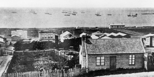
Ōamaru’s coast was just as exposed as Timaru’s. Indeed, for 15 years from the early 1860s it was one of the colony’s most notorious shipwreck sites. But still the ships kept coming, so in time the Oamaru Harbour Board, formed in 1874, constructed a safe harbour that is now New Zealand’s most authentic Victorian/Edwardian deep-sea port. On it rested the prosperity that gave Ōamaru its magnificent limestone buildings.
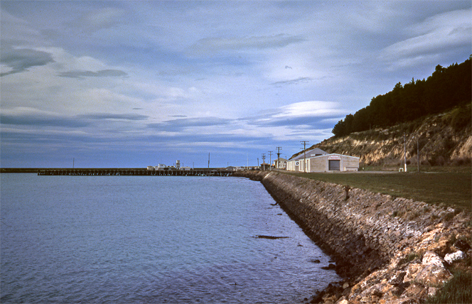
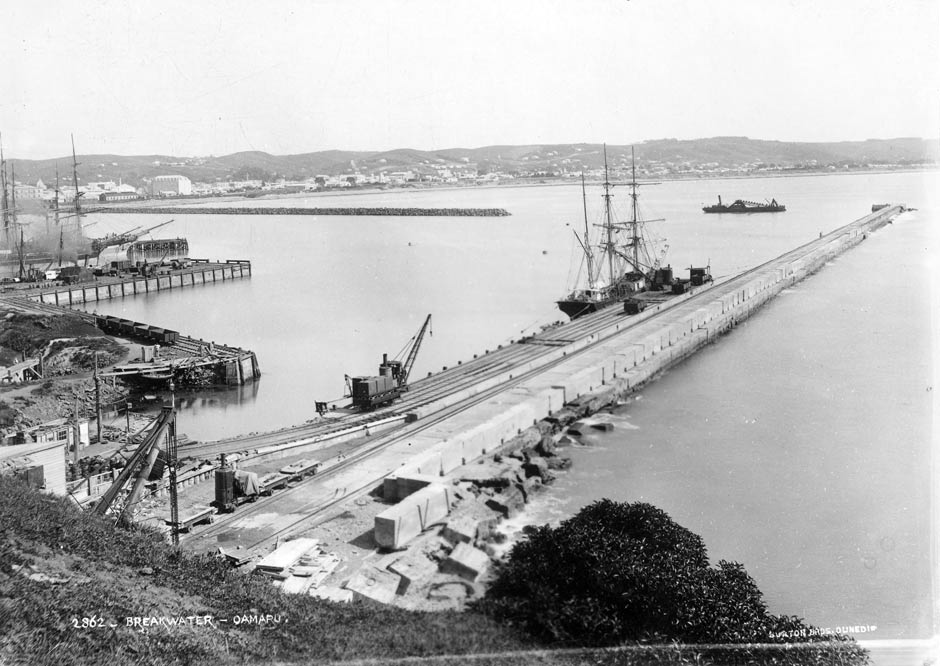
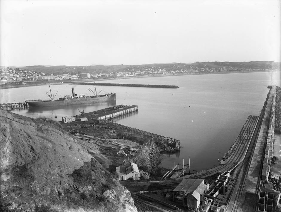
There is much to see, even though its only visitors are now fishing vessels and pleasure craft. The basic port layout dates from 1872-84. The main wharf, Holmes Wharf, began life in 1880 as the North Mole, a long, slender finger of rock that protected the wharves from northerly surges. At the beginning of last century, as ships outgrew Sumpter Wharf, Thomas Forrester designed a bigger wharf to run along the mole. It was his last and biggest job in Ōamaru. Named after the harbour board chairman of the day, Holmes Wharf opened in 1907 for ships of up to 10,000 tons. The wharf was last modified in the 1960s and last used by cargo vessels in 1974.
The south side of the port is the more historic. Walk seawards along the old stone seawall from the Esplanade to Sumpter Wharf, which is now visibly decaying. It was a different story in 1884. Then the elegantly curving timber wharf, graced by white-painted handrails, welcomed the biggest oceangoing freighters running between New Zealand and Britain. From here the sailing ship Dunedin, carrier of New Zealand’s first shipment of frozen meat, sailed into oblivion in 1890. Big British tramps loaded grain during the South African (Boer) War. Sumpter Wharf fell into disuse between the wars.
As the heritage trail board on one of the wooden sheds near Sumpter Wharf explains, Ōamaru has an Antarctic connection. In early 2013 the town marked the 100th anniversary of a boat from the Terra Nova breaking the news from Ōamaru of the death of British explorer Robert Falcon Scott and his companions.
The little jetties are recent but above them you will see a relic of Ōamaru’s notorious shipwreck days, a mast from the Robert and Betsy, wrecked in 1862. In 2011 this was reunited with an old companion, the restored signalman’s hut. Our next wharf, Normanby Wharf, a wide concrete wharf with water frontage on three sides, was completed in 1878. Running off the eastern side of it are the crumbling remains of the Cross Wharf, for many years the base for Scott’s Own Sea Scouts and also home to a restaurant. Across the road you can see the historic former harbour board quarry, blasted from Cape Wanbrow over a period of 100 years. The jaunty cluster of red corrugated iron workshops (now known as ‘The Red Sheds’) were built for the board and have now found new uses with artists and steam railway enthusiasts.
Finally, we reach the breakwater, now bordered by the popular blue penguin colony. It has two parts. The short concrete wharf near the beach is Macandrew Wharf (1875), named after wily Otago Superintendent James Macandrew, who once charmed the locals by predicting that Oamaru’s docks would one day rival those of London. It has silted up and has been breaking up for decades, but in the 1870s the Dunedin-Ōamaru passenger steamer fought sailing vessels for space alongside it.
The breakwater (1872-84) was built in stages by Walkem and Peyman and Miller & Smillie. Even before it was completed, the 564-m-long concrete structure had transformed the port’s once-atrocious safety record, although it almost sank the contractor building it. Nevertheless, the storm-tossed breakwater has always given the authorities headaches. The landward end was raised between the wars and has been patched many times since. The rocky spur halfway along is the shrinking remnant of the Ramsay Extension, built during the Depression to provide a sheltered shipping channel out to deeper water. Work stopped at 220 m when the board ran out of funds in 1944. The weak quarry rock soon crumbled away.
The harbour was largely neglected after closing in 1978, but recently the council has landscaped and interpreted large parts of the area.
Further information
This site is item number 40 on the History of New Zealand in 100 Places list.
On the ground
Information displays, former Oamaru Harbour Board Building, 2 Harbour Street. Harbour heritage trail along the waterfront.
Websites
- NZ History feature
- Heritage New Zealand List entry
- Ports of New Zealand
- Waitaki District Council Harbour Development Strategy (PDF)
Book
- Gavin McLean, Kiwitown’s port: the story of Oamaru Harbour, Otago University Press, Dunedin, 2008
Community contributions