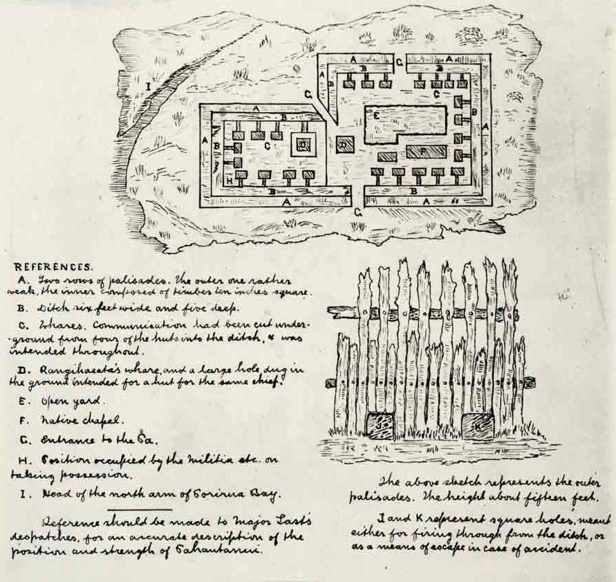
This ground plan of Te Rangihaeata’s pā at Pāuatahanui shows two rows of palisades, a six-foot-deep ditch, several whare, an open yard and a chapel. The sketch at lower right shows the outer palisades, which were over 15 feet in height. The holes near the ground were probably for firing through.
A series of British raids on this pā, built on the site where St Alban’s church stands today, forced its abandonment. More than 300 Ngāti Toa, including women and children, withdrew north to a ridgetop east of the Horokiri Stream that is now known as Battle Hill. The abandoned pā was turned into a British military post from which detachments of regular troops protected the Europeans who settled around the inlet.
Community contributions