
You can also download a hi-res copy as a pdf (18.1 mbs).
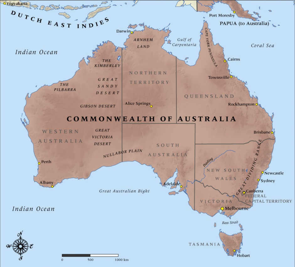
This map shows the state borders of the Commonwealth of Australia at the time it entered the First World War in 1914.
Note that Canberra was a city in name only in 1914. When Canberra was selected as the site for the capital of the Commonwealth of Australia in 1908, Melbourne was designated as the seat of government while the new town was constructed. Canberra was located in southern New South Wales in a rural area that was initially known as the Federal Capital Territory. Construction work had barely begun in earnest when the outbreak of the war in 1914 brought it to a grinding halt. Not until 1927 was the Federal Parliament building completed, allowing the Commonwealth government to move from Melbourne to Canberra.
Community contributions