Map showing the main battles of the Musket Wars
Major battles in the 1820s
In the early 19th century, Māori movement and migration took on new aspects while retaining many parallels to the journeys of earlier periods.
The opportunities presented by the arrival of Pākehā (European) traders, whalers, and timber and flax millers at places such as the Bay of Islands, Kaipara, Tāmaki, Kāwhia, Mōkau, Māhia and Kāpiti attracted Māori to these areas, often from great distances.
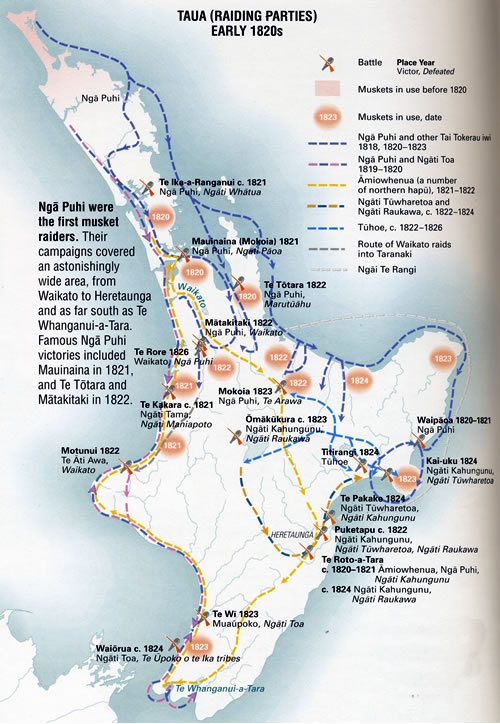
Ngāpuhi in particular benefited from their early contact with Europeans by securing access to firearms, which they used in raids on other tribes.
The northerners’ military campaigns covered an astonishingly wide area, from Waikato to Heretaunga (Hawke’s Bay) and as far south as Te Whanganui-a-Tara (Wellington). Ngāpuhi won great victories at Mauinaina in 1821 and Te Tōtara and Mātakitaki in 1822.
Their near neighbours bore the brunt of their assaults. Ngāti Whātua sought refuge in Waikato and Marutūahu fled to the upper Waihou valley, south of the Firth of Thames. Areas such as Tāmaki (Auckland) and the lower Waihou valley were temporarily depopulated.
Community contributions